Showing posts with label Riding Mountain National Park. Show all posts

Tuesday, March 10, 2020

Riding Mountain National Park - May 2019, Part 2

Here's the second and third day of our 2019 May Long Hike in Riding Mountain National Park. The hike continued to be interesting, but since we want to get to some new topics and document all our trips I'm going to be doing more than one day per trail post going forward!

Date: May 19. 2019
Length: 17.65 km
Elevation: 343 m
Time: 6 hours 18 minutes


Whitewater Lake to Gunn Lake


Date: May 20. 2019
Length: 15.91 km
Elevation: 393 m
Time: 5 hours 14 minutes


Gunn Lake to Baldy Lake Trailhead

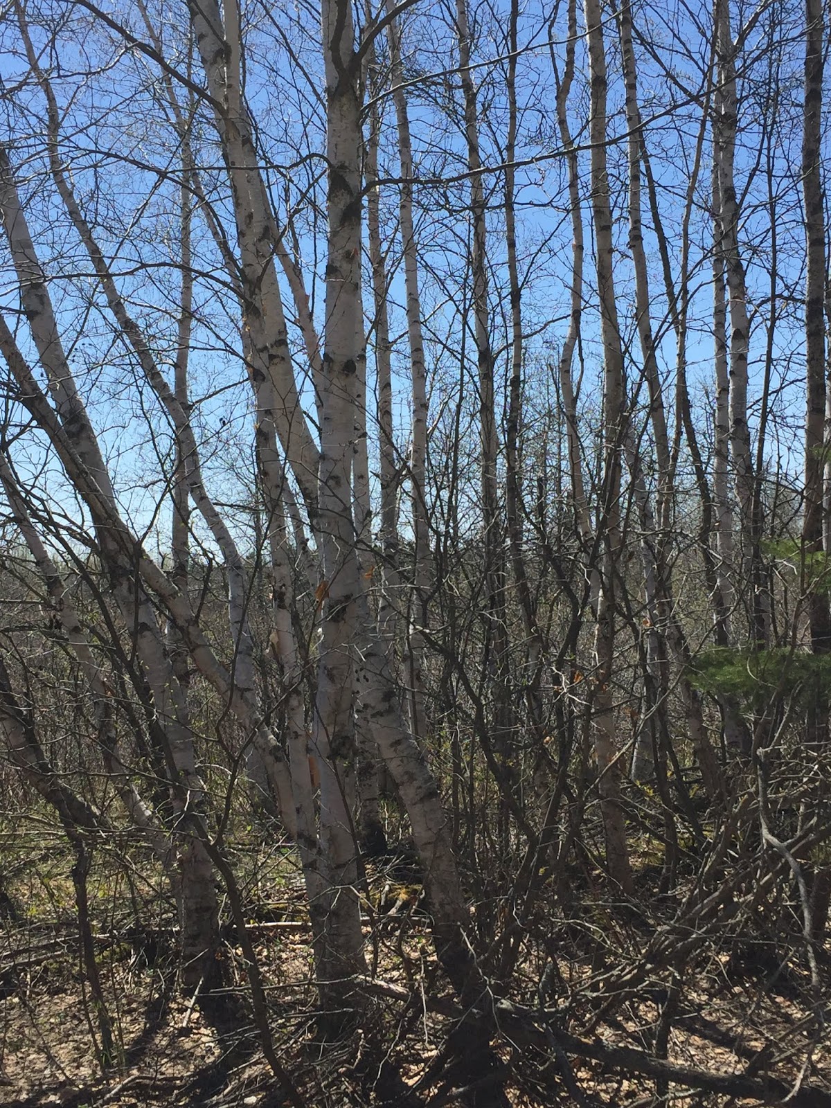
On day 2 we woke up early and hit the trail. The Central Trail in Riding Mountain is a nice easy hike, generally 3 to 4 people wide and with very gradual elevation changes. While we walked we were surrounded by spring finally starting in full. Trees were starting to bud and grass was growing. All the slight spots of green stood out in contrast with the beiges and greys that still lingered from winter.


One great part about the day was the crisp air and the bright blue sky. There were some fairly large clearings with a dark fringe of trees in the distance and a large never ending sky. Roslyn described standing in the middle of one of them as making you feel like a small prey animal. Fortunately for us (or maybe unfortunately!) we didn't see any predators around.


Coming into camp for the night we got a good walk up and down the ravine that is just before the Gunn Lake campsite. The actual camping area is raised up on a hill surrounded by thick brush and trees, so we weren't worried about water or wind! We started up a fire and set our tents up before having supper. We went to sleep fairly early again to get out of the wind and to try and get going early in the morning!


Waking up early, we enjoyed some time down near the water just poking around before heading out. The water was smooth as glass and there were some cool looking snails and bugs crawling about. We walked up and down the shore line for a bit just to see what was around.


The rest of the day passed pretty quickly. We were mainly walking through areas will tall stands of trees and the occasional beaver dam or marsh area with a raised trail. The scenery was still beautiful in a stark somewhat haunting way.


One moment of excitement happened just after lunch. We had just started down the trail when one of us noticed a dark black shape up ahead. It took us a couple seconds to realize is was a bear using the trail too! We shouted out the customary 'HEY BEAR' and the little black bear noticed us finally and sprinted off into the trees. After a couple minutes we headed out again and ended the last few hours without any more excitement (other than the normal I'm out hiking! excitement).

Tuesday, February 25, 2020

Riding Mountain National Park - May 2019, Part 1

Date: May 18, 2019
Length: 16.8 km
Elevation: 398 m
Time: 5 hours 9 minutes

Long Lake Trail to White Water Lake

Last year for May Long weekend we decided to head out to the central portion of Riding Mountain National Park and enjoy a three day trip. May Long is usually pretty hit or miss with the weather, but we decided to use the motto 'If there's no snow, then we're gonna go!'. It's always an interesting to hike this time of year here because on Day 1 we are usually walking through a brown, dried out landscape and by Day 3 the trees are budding and the grass is starting to come out!

To start the trip Roslyn, Tyler and I, drove into Riding Mountain and stayed with Roslyn's mom at a cabin on the Friday night. Saturday morning we drove two vehicles out and dropped ours off at the end of the trail, with Roslyn's mom giving us a ride to the trailhead we were planning on starting at.

Us at the Trailhead!

It was a fairly late start, with us hitting the trail at 10 am. We spent a couple hours hiking along through some stark looking scenery. Come summer the area would be nice and vibrant, but May Long is still spring and the cool temperatures keep everything from growing too well. 

Some of the mornings trail scenery

We also happened to find a knife lodged in a tree at one of our break spots. We spent the next hour trying to figure out what nefarious deeds and led to it being abandoned in a perfectly nice fir tree.

The now infamous knife!

Near lunch we arrive at a camping area and took advantage of the picnic tables to eat on. During lunch and a bit before it, we could hear some trees snapping and falling over due to the wind, which was pretty cool. Before heading out again we filtered some water and enjoyed sitting by the lake.

Long Lake

The rest of the day was spent hiking along a nicely treed trail with a few small creeks to cross over. We arrived at our camp site around 3 pm and explored a bit since it was a former POW camp in World War 2. We read some of the placards and walked out around the area. Roslyn also saw her first cow and calf moose! We didn't manage to get any good pictures tough because it was too close, so we shot some blurry video then walked off to safety.

Long Green Tunnel

Summer is coming!

That night we built a campfire with the wood provided and ate supper fairly early. Our tent nearly blew away while trying to set it up, and we ended up in bed around 7 pm just to get out of it. Over night the temperature dropped to about -1C, so between that and the wind we were convinced to stay in our sleeping bags!

The first day of the trip was pretty enjoyable. Long Lake Trail and the section of the Central Trail in Riding Mountain National Park are easy to walk on, clear of debris, and wide enough for 2-3 people to walk side by side. Getting to walk and talk was a nice change from always being in front of or behind someone and trying to yell at each other!

Riding Mountain remains a consistently nice place to hike no matter where we go, and we suggest you try it out if you're ever in the area!

Thursday, June 21, 2018

RMNP East Border to East Deep Lake via J.E.T - Day 3

Date - May 21, 2018
Length - 17.1 km
Elevation - 238 m
Time - 5 hours 25 minutes


AllTrails map of the trip out on Day 3

Day 3 started bright and early, with the two of us waking up at 6 am with the plan to have everything packed up and ready to go by 7 am. We got dressed, packed up and emptied the interior of the tent, then Roslyn began breakfast while I packed up the tent. Once the tents were packed I started filtering water again to make sure we were topped off for the hike out.

Packing up the tents while Roslyn makes breakfast

Our fuel canister was getting low on fuel and it was pretty windy so boiling water for breakfast took longer than expected, as did getting everything washed up and packed in the first place. By the time we were ready to go it was 7:45 am. A bit of a late start, but it was our first time and we are sure we'll get better at it.

We started the hike out and about 15 minutes into it we hear what sounded like trees knocking together, or antlers knocking on trees. We slowed down and were expecting to see an elk or deer walking through the close trees in the area, but we were surprised by a bear cub popping out of the trees about 30 feet from us instead! We looked around for momma bear and started shouting "Hey, bear". Momma bear wasn't around so we backed up about 30 feet and waited for the bear cub to run off. Be next kilometer was more of the close in trees with a few blind hills, so we took it slowly until we were about a kilometer past the bear siting.

The trip out was much more green than the trip in, which made it pretty interesting to walk through in comparison. All of the tree tunnels were roofed so it kept the sun off and the buds and flowers that were coming out were pretty.

On the way out we stopped at the lookouts to see the view.

Panorama looking out from the North Lookout

Looking west from the North Lookout

Looking east from the North Lookout

In the picture looking west from the North Lookout you can see a few hill slides on the edge of the valley. It turns out they all hit Packhorse trail, which is why it was closed. We are very glad we didn't try to take the trail after seeing them.


Looking east from the South Lookout

Panorama from the south Lookout

In Roslyn's words:


We tried to do a fast tear down in the morning, but with it being our first time doing this back country, it took a little longer than we would have liked. I'm sure this will improve with time as we get more and more familiar with gear and our roles. It definitely wasn't a dull morning walk out of camp as we ran into a bear only about 1 km out of camp. It looked like maybe a 1 year old cub with no mama in sight. We responded as one is supposed to, make noise and back up slowly. It really did not want anything to do with us, typical of a little black bear, so we got back to hiking pretty quickly.


It was absolutely amazing how much the forest had changed in the 2 days since we came in. There were tons of leaves on the trees which made for some really nice intermittent shade. There were flowers blooming on some trees, and the park just seemed more alive. Yay spring! We took the time on the way out to hit the two lookouts we skipped on the way in and my goodness was the extra 2 km worth it. The north lookout is perfect for a lunch break on the way out. There is some solid shade and clear shale ariea to through down at. Just be careful not to drop anything off the cliff or let your water bottles roll down the hill. It is very steep.  When you go to the south lookout, make sure you walk along the shale, it is questionable whether or not there is an actual trail there, but when you round the corner, you can see bald hill very clearly.


The last km hurt but the promise of DQ was a definite will booster. Over all the trip was just amazing. I has 100% confirmed that I really do enjoy backpacking. I will definitely take the cold nights, sore feet, blisters, bugs for the smell of the forest, seeing the colours of the plant life, watching the wildlife, gazing at the stars, and the feeling of being in the middle of nowhere.

With our first real backpacking trip out of the way, we have determined that we need to use a checklist, look into a better water filter, and that backpacking is definitely for us! We also need to look into a lighter tent and bringing less food to help cut down on weight.

All in all the trip was amazing, and we can't wait to do more!

Monday, June 18, 2018

RMNP East Border to East Deep Lake via J.E.T - Day 2

Date - May 20, 2018
Length - 10.2 km
Elevation - 192 m
Time - 2 hours 15 minutes

This the second post in our first “series”. The previous post, this post, and the next one cover our May long weekend backpacking trip through an eastern section of Riding Mountain National Park. The total mileage for the trip was 42.6 km. Each post covers one of the three days of hiking!


One way map from EDL to Breezy Hill

Day two was nominally the 'rest and relax' day of the three day trip. We had no mileage planned and were just going to hangout around the camp site. I'll give a bit of an overview of the campsite here, as I forgot to in the last post.

The campsite was large enough for two tents side by side, with a picnic table and a fire pit. The ground quickly sloped down to the water and towards the other campsite in the area so there was not a lot of flat ground, but enough for our group. The camping area also has firewood provided so you don't need to collect your own, steel bear canisters, and a covered outhouse with toilet paper provided. All in all, a pretty cushy camping area.

Campsite 'entrance' looking past the sign in box
To EDL Campsite #1, our neighbours

Open area between Site #1 and Site #2, with the
bear boxes for your food and scented items

Tents stove, and picnic table on Site #2, our site

So, starting from going to bed on Day 1. Overnight the temperature dropped down to 0 C (30 F). Our sleeping bags were good for the temperature, but we had forgotten our sleeping pads. We knew about the forgotten pads the day before, we just didn't think it was a big deal. Tyler had simply decided not to bring a sleeping pad. After experiencing the night on the ground all three of us are going to make sure we don't make the same mistake again.

The problem wasn't that the ground was uncomfortable. The "comfort" part of it was more than adequate. Our problem was the cold. Throughout the night we could feel the ground leeching the heat out of our bodies. It turns out that sleeping bags provide warmth because of their 'loft' and how many air pockets they have for your body heat to warm up. When you lay down on the sleeping bag your body compresses it to the point where there's essentially no loft left in it, so it provides no insulation or warmth. The sleeping pad helps with this by getting you an inch or so off the ground with air pockets that your body can warm up. So, lesson learned, always bring a sleeping pad.

Due to the poor sleeping conditions, animal noises, and growing light, I woke up for good around 5 am, and got out of the tent for the day around 6 am. Roslyn was up a bit before 6 as I dressed, and was out around 6:30. Tyler and I set about filtering water, which I will talk about a bit more later, and Roslyn and I made oatmeal with dehydrated blueberries and mil for breakfast. Tyler and Mathew ate granola bars. The oatmeal was a really great way to start the morning, especially since it was still cool out and only around 5 C.

After hanging around talking for a while it began to warm up. We realized we didn't have any shade, and at around 10:30 am we decided to try and do something about that. We decided on moving to Breezy Hill campsite about 5 km away to see if there was any available shade. Setting up for a quick day trip we packed water and lunch and headed off.

The 5 km trip was fairly pleasant with a good amount of intermittent shade, which was very appreciated. On the way we saw quite a few set of animal tracks, including some faint bear tracks and lots of deer and elk tracks.

Elk hoof print

At Breezy Hill there was a water pump, the water still needed treating, a horse corral, an out house, provided firewood, and three camp sites. Luckily no one was camping here and we moved a picnic table into some shade provided by a tree and waited out the afternoon heat. Around 2 pm we decided to head back to our campsite and were back around 3 pm.

Once we got back to the campsite, we started filtering water. Just as we were finishing, a helicopter started circling the campsite. It made its way over to a dry part of the lake bed a beaver dam had cut off and landed. Three rangers came over to the campsite to put up a notice of the fire ban that was in effect. We were quite happy that that was all it was. We did not fancy the idea of having to pack up and hike out.

Helicopter taking off and going to Breezy Hill to
deliver another fire ban notice

We spent another couple hours sitting around talking before supper, which was dehydrated vegetable flake, bacon bits, and instant mashed potatoes. After cleaning up supper and filtering more water we waited and watched the sun set again before heading off to bed.

Complete still water about 30 minutes before the sun went down

In Roslyn's words:

Day one ended and Day two started with a very cold night due to us forgetting our sleeping pads. I still can’t believe we actually forgot our sleeping pads on a night where it got down to 0 degrees C. Well we definitely learned our lesson. The sleep was not overly uncomfortable, just very cold. I was trying my best to sleep on my side as it was much warmer with as little body touching the ground as possible. I did try sleeping with my pack under my legs but with me trying to stay on my side, this did not work very well. I will definitely try it again when we have our sleeping pads.

A nice bowl of hot oatmeal and hot chocolate warmed us up to a beautiful day. As the morning grew warmer, we decided a hike to the Breezy Hill campsite might be worth our time as our site had no shade. It was a nice easy hike with no real elevation challenges over the 5 km there. The Breezy Hill site was a nice setup if you had horses with you, and we did find some wonderful shade by a picnic table, but filtering water would have been a challenge. The water source was a well and pump which would not have worked well with our hand pump filter. In general our hand pump water filter does not seem like a good fit for us. It is quite large and a hassle to use and clean, prompting us to look into other options for our next trip.

After getting back to the East Deep Lake campsite, we had a bit of excitement with three rangers coming in a helicopter to deliver a fire ban notice (we knew about it already). We were soooo happy that they were only delivering a fire ban notice and not instructing us to evacuate due to a forest fire. I mean, a helicopter is a hell of a ride to deliver a piece of paper. After that, it was a lazy afternoon with a muskrat siting and us trying to stay up to see the stars. I ended up giving up and waking up at 2 am to see the stars without light pollution. Definitely worth it.

Our biggest pet peeve this trip has definitely been the water filter. Its a simple hand pump filter that forces the water through a ceramic filter. Our main problem with it is that after about 2 liters of water you have to wash it or else the flow rate becomes nearly zero. This wouldn't have been a problem if it were just one of us, but we were trying to filter water for four people with the one filter. That being said, it works well for its intended purpose, we were just trying to get more out of it that it could provide. We are currently looking at the Sawyer Squeeze and plan on testing it out soon to see if its the right fit for us. The other option we have been looking at is a gravity filter. Our neighbors on this trip had one and it seemed to work quite well.

Overall, Day 2 was very enjoyable and we would both recommend coming out here if you like backpacking.

Thursday, June 14, 2018

RMNP East Border to East Deep Lake, via J.E.T

Date - May 19, 2018
Length - 15.3 km
Elevation - 567 m
Time - 5 hours 37 minutes

This the first post in our first “series”. This post and the next two cover our May long weekend backpacking trip through an eastern section of Riding Mountain National Park. The total mileage for the trip was 42.6 km. Each post covers one of the three days of hiking!

AllTrails map of our route to East Deep Lake

Finally, our first actual backpacking trip. This one is no mere training hike but a three day trip out in Riding Mountain National Park along the Packhorse and J.E.T trails. At least that was what we thought it would be. Unfortunately, Packhorse is permanently closed so we ended up taking J.E.T both ways. This routing change did not lessen the experience in the slightest however because our hike in had nearly no blooming on the trees, but on our hike out two days later all the trees and flowers were in bloom, completely changing the sights on the hike.


So... Day 1.

The trip started Friday night with Roslyn, our friend Tyler, and I driving from Winnipeg to Brandon to stay at Roslyn's mothers house. The next morning we were up at 6:15 am packing everything into the car again and picking up Roslyn's cousin Mathew at 6:45 am. By 7 am we had picked up breakfast at Tim Horton's and started the drive to the trail head.

A bit less than two hours later, we were driving down a dirt road about a minute from the trail head. This stretch of road gets a special mention because the Honda Civic we were driving in bottomed out a few times. If you're driving a low car beware, drive around the loose gravel in the road as you will sink into it. Another reason this section needs to be mentioned is that we got lost about 20 seconds from the trail head. It not visible until you are right on top of it and we spent maybe 5-10 minutes looking for it on foot down a side road the Civic couldn't traverse. Once we found the parking lot we parked pretty carefully as there's only room for about 2 cars in it.

The start of the trail is a nice, easy walk, with minimal elevation change along Bald Hill Trail. After about 1.2 km we came to the Packhorse trail head. As mentioned, we originally planned to travel this trail, but after about 100 feet decided against it due to the obvious lack of upkeep and too much deadfall on it.

A little under 2 km later we came to the Bald Hill-J.E.T trail junction. Taking the turn onto J.E.T trail we had our first, and only, water crossing of the trip. The creek here is only about 10 feet across and 4-6 inches deep. Tyler and Roslyn walked through it, and Mathew and I rock hopped across it.

Creek Crossing
The creek it as the 3 km mark, which is basically the bottom of a pretty steep climb that gives an elevation change of 90 m over a kilometer. At one point on this climb the grade reaches 32 degrees, which is pretty steep when you're carrying 30 lbs of gear. On our way up we were passed by two guys trail running. About 30 minutes later one of them was returning down the trail and warned us of a bear cub ahead near the official look out points.

Right at the top of the first climb there is a wonderful look out site, and not the one that has a bear cub! It was a nice place to catch our breath and made the climb worth it.

Lookout point over the valley

From here the trail eased up a bit for the next two kilometers. While not flat, I wouldn't say it was a climb either. About halfway through the flat section there are two side trails, one to a look out on the north side of the spur and another to a look out on the south side. Having been warned about bear cubs in the area we decided to check it out on the way back and moved on.

After the flat section we began the second climb. This climb was definitely worse, rising 56 m over 0.4 km of travel. At one point the grade reached 44 degrees, which looks and feels like a everything is straight up when you're leaning into it with a 30 lb backpack.

Beautiful Tree Tunnel Walk

From here on the trail is relatively flat, with generally gradual ups and downs. The kilometer after the second climb is a beautiful tree tunnel. Eventually you come out of tunnel very suddenly to the view below.

Large muskeg lake

The trail only followed the edge of the lake for a few hundred meters, but it was cool watching the wildlife in it, even though we only saw birds.

Walked through a lot of stands of trees that looked like this on the way in

The last 6 km after the lake were enjoyable. There are 2-3 old large beaver dams that you walk across, not that you'd recognize them as such any more.

At around 3:30 pm we made it to the camp site and set up camp.

View down the trail from the camp site

View out over the lake at the campsite

In Roslyn's Words:


And so our biggest adventure yet begins! The start of the trail is a very calm and easy walk to the main trail junction and is quite a nice warm up. It was somewhat disappointing to have to change our plans from Packhorse to JET both ways, but without the proper equipment it is better to be safe than sorry, and it was a good thing we chose safe. The shale washouts made it look impassible without full on climbing gear.

Looking back on the bear sighting at the viewpoints on the way in, it was a good thing we skipped them as the full hike in ended up being longer than anticipated and not easy. This trail goes from low farm land to the highest point in the park so there was some intense long incline stretches. At one point I would look up the trail, find a point about 100 ft away, and focus on getting to that point. Once that was accomplished I did it again, and again until we made it to the top. It was a great challenge that is often hard to find in Manitoba.

Finally getting to camp was very satisfying. I felt that I had really accomplished something that day. We were at East Deep Lake campsite #2, but if I were to go back, I would try to reserve site 1 as it had more shaded area and better ground for pitching a tent. By the end of the day we were a little bored as we forgot to bring some cards but our spirits were high as we ended the first day watching the trees reflecting in the lake.
Once camp was setup we ate supper, which was ramen with vegetable flakes and sausage chunks cut into it. Nothing tastes as good as food eaten while hiking or camping, no matter how bad the food actually is. We spent the evening filtering water (more on that in the next post), watching the wild life in the area, and occasionally chatting with our neighbors in the site next to ours. We tried to stay up late to see the stars come out, but with twilight still hanging out around 11 pm we went to bed and vowed to see them the next night.

All in all, it was a great day.

Tuesday, June 12, 2018

Kinosao Lake Trail

Date - May 13, 2018
Length - 7.4 km
Elevation Change - 169 m
Time - 1 hour 42 minutes


AllTrails map of Kinosao Trail


A short 5-10 minutes drive into Riding Mountain National Park from Wasagaming, Kinosao Lake trail is a pleasant jaunt through the park, perfect for an easy morning hike to get out of your cabin or as part of a day trip to experience what Riding Mountain has to offer. The trial is well kept and generally wide enough for two people to walk side by side.


The dock at Kinosao Lake

Two kilometers into the hike you arrive at Kinosao lake. There's a nice picnic area and a dock for swimming off of. One of the things we really enjoyed was the canoe that was there. We didn't actually use it, but it is a community use canoe that one of the residents maintains for everyone to use, including making sure there are paddles and life jackets.

View out over the lake

Wider shot of the picnic area

Unfortunately, for this and a few future hikes, my phone was not saving pictures all of the time so there are quite a few lost pictures and a few lost videos. With the issue found though I can be more careful and make sure we get all the pictures the two of us are taking shown here. There were quite a few marshy areas that we took pictures of, they have walkways over them for ease of use, as well as a 360 image of the lake from the dock. I guess you will just have to get out on the trail to see it!

Approach to Kinosao lake from Brule Trail

View from the Brule Trail approach

The dock has a second trail, the Brule Trail, come out to it as well. While we did not hike Brule, it is an easier trail meant for allowing people less able to hike over elevation changes to get to Kinosao lake.

In Roslyn's words:


"This trail is a very nice walk through the woods with a flat wide trail and a few small rises and falls. When the trail meets the lake there is a very nice, well kept floating dock with a community canoe. There are life jackets provided and stored under the canoe as well. A community canoe is such a wonderful piece of equipment to provide and I ask that anyone who uses it please respect the equipment and treat it with care. This is a real treat and it would be such a shame for it to be damaged. All in all, this was a lovely morning hike and look forward to one day trying out that canoe."

The remaining 5.4 km after getting to Kinosao lake was nice for a quick morning hike as well, with plenty of small ups and downs. We say signs of plenty of wild life in the area, including bears, but only saw a few types of birds. All in all, this is a the two of us would recommend everyone tries out.