Showing posts with label Brereton Lake Trip. Show all posts

Thursday, August 9, 2018

Rainbow Falls from Jessica Lake Lodge

Date - June 19, 2018
Length - 8.6 km
Elevation - 272 m
Time - 3 hours 24 minutes

Sorry for being a week late and missing two posts. We had issues coming back from Germany and arrived about 48 hours late back in Winnipeg. Dealing with that, catching up on sleep, and preparing/hiking on the long weekend left us with little time to get a Tuesday post up, let along one last week. We are back now fortunately!

Trail Map for the hike

This was a fairly easy hike, the only challenge was the heat. The trail is a section of the Trans-Canada trail the starts at the Jessica Lake Lodge. The trail is well kept and about 6 feet across. The footing is gravel along pretty much the entire length of it.

Tiny flowers we saw along the way

Rainbow Falls was a pretty area, though it is very popular. There is a campground with a store right by it and it is a popular area to go swimming. We hung out at the falls for about an hour, enjoying the water and having some lunch.

View from the top

Our group hanging out at the top of the falls

The swimming area

The hike had a few benches along the way and some nice views of Jessica lake to the east. All in all it was a good wrap up hike for the Brereton Lake weekend.

In Roslyn's words:


This trail was pretty nice, not overly difficult, but also not anything super exciting. The waterfall at the end however is quite spectacular. If you do not want to do the hike, there is a parking lot right at the falls where you can just enjoy Rainbow falls. There were some children swimming in the area as well as someone fishing close by which was not super comforting. It is not an overly safe area for small children to swim as there are some strong currents and it does look like people often fish close the the same area, leaving the possibility for lost fishing hooks underfoot. It is however a great place to go see and explore and I would recommend a visit.

Thursday, July 12, 2018

Amisk Trail with Inverness Falls Extension

Date - June 9, 2018
Length - 6.7 km
Elevation - 38 m
Time - 2 hours 7 minutes

All Trails Map of Amisk Falls Trail

We set out to do Amisk Falls after setting up at Brereton Lake Campground and having supper. We got to the trail head around 7 or 7:30 and by the time we came back the sun was on the way down. The near night hiking was interesting and we enjoyed it.

Back to the beginning of the trail though. The trail head has a nice sized parking lot with an outhouse at it. There were a couple other vehicles parked there, but I would guess there's room for 15-20 vehicles so it wasn't a big deal.

Heading out on the trail, it travels through pine forest up and over some small high points with decent views of the surrounding marsh land and the river.


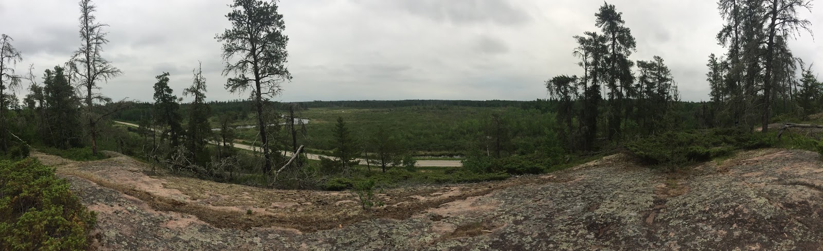
Panorama of the approach to the first look out site

The first look out site

The first look out site from in front of the bench

One nice thing about Amisk Trail was that there were 5 look out points with a couple placards to read and benches to sit on. Since we were pretty tired at this point, the extra areas to sit and rest were a wonderful bonus.


Rennie River, looking down stream from look out #4

Rennie River, looking up stream from look out #4

One thing I would like to point out is that the inclusion of Inverness Falls was something we though would be interest, but was mainly disappointing. It turns out that Inverness Falls is a man-made water fall area built to block one of the Brereton lake out flows to increase the water level. I really wasn't much to look at. Additionally, we spent about 5 to 10 minutes looking for the Trans-Canada trail spur that would lead us to it. The trail spur is maybe 100 m north of the #5 rest spot placard at the descent to the last river look out on the Amisk Trail.

In Roslyn's words:

The Amisk trail was a very nice hike typical of the Whiteshell Provincial park. Lively green tree tunnels opening up to large open rock faces with great views of the river. It was hard to find the extension path leading to the Inverness Falls but we did find it eventually with some extensive searching and map referencing. The Falls themselves were pretty disappointing. We had no clue what kind of falls we were going to see to start with so when we found out they were man made falls, mostly hidden by a bridge, it was a bit of a let down. There exists a path that leads down the river to a better view of the falls but it is only open to Inverness resort guests. One thing that I did find cool was that because the water was a dark clear colour, the falls looked like a waterfall of root beer (my favorite drink). I definitely do not regret going to the Inverness fall and don't necessarily suggest others skip it, but just a heads up to everyone that there are no spectacular waterfall views at the end.

All in all the hike was great, and only took as long as it did because of us stopping to take breaks at the end of the day.

Monday, July 9, 2018

Cabin Lake Trail

Date - June 9, 2018
Length - 6.0 km
Elevation - 21 m
Time - 2 hours 43 minutes

AllTrails Map of Cabin Lake Trail w/ a short Trans-Canada addition

Cabin Lake Trail was the second trail we did on our Brereton Lake trip. It was a nice hike with a good variety in scenery as it goes up and down through a wetland. There are a few beaver dams in the area creating small lakes, and one that is a few hundred feet long you must walk across near the start of the trail.

The high area of the trail between the two marshlands is covered in beautiful flowers. Roslyn spent plenty of time taking pictures of the Lady Slippers and others in the area.

Cluster of Lady's Slippers, Manitoba Provincial flower

Not sure what these are, but they're pretty

A close up

Interesting looking flowers on the trail

Up close shot of a Lady Slipper

Near the end of the high land in the middle section of the trail, there's a very strategically placed beaver dam holding back quite a lot of water. The positioning of it was quite impressive.

Beaver dam along the top of a rock face

At the end of the Cabin Lake Trail section, there were probably a dozen or more boats all pulled up on the shore. We saw someone on one later on when we were at the Trans-Canada trail campsite. They mentioned that some of them boats were public use, but we weren't able to confirm that with anyone else.

From the end of Cabin Lake Trail we did a short section of the Trans-Canada trail out to a camp site. The section drops down and goes through the wetland area again. Its a short section, only about 50 feet, but there's plenty of opportunity to get your feet wet. After that its about a 0.5 km at most to the camp site. We didn't stay there, but there's probably room for 4-5 good tenting sites. All of them are on the bedrock that permeates the area, but there are plenty of rocks around to hold down the edges of your tent.

Panorama from the camping areas shore

In Roslyn's words:

Almost right when you start the trail you are presented with the largest obstacle of the trail, a boggy beaver dam. Although it may seem intimidating, it is not as bad as it look, but waterproof shoes would definitely be your friend. The trail as a whole is moderately difficult, with the forest to rock clearing landscape you would expect from the Whiteshell. The end of the trail offers a pretty view of the lake and a graveyard of boats from travelers past. Though some boats are sunk, some are in good working condition and look be used for communal recreation. Just remember to be courteous of others and respect this equipment. Having been told about a small extension of the trail (part of the trans canada trail) by a lovely couple on our way in, we decided to explore a bit more. This trail was much less defined but still easy enough to follow if you look for the bright tag flags. This trail extension leads to a lovely backcountry campsite. If you plant to come spend the night, be sure to bring a sleeping pad as you will be pitching your tent on rock. I recommend coming out to this camp if you are doing this trail as it is a much nicer resting point than the actual end of the Cabin Lake trail. We will definitely be coming back to this site for a quick overnight stay sometime in the future and I would highly recommend it to anyone wanting to try out backcountry camping for the first time but not wanting to hike out 13+ km on their first trip.

All in all it was a great 6 km.

Thursday, July 5, 2018

Pine Point Rapids and Viburnum Falls Trail

Date - June 9, 2018
Length - 8.9 km
Elevation - 257 m
Time - 2 hours 51 minutes

AllTrails Map of Pine Point Rapids and Viburnum Falls Trail

This was the first of four trails we tackled the weekend of June 9th and 10th during our Brereton Lake Campground trip. It is also my favorite trail of the trip. 

So, a group of us made of of myself, Roslyn, and our friends Tyler, Steve, Curtis, and Patrick met at our apartment at 6:45 am on June 9, jumped into two cars and set off for Pine Point Rapids trail in White Shell Provincial Park. The drive was pretty standard for Manitoba, but became interesting once we got to the Pinawa Dam area and started driving through the park.

Once we hit the trail head we quickly got our day hiking gear on and set out down the trail.

Start of the Pine Point Rapids Trail

The start of the trail is a quad and snowmobile route our to a warming shack that operates year round, so it was well developed and fairly road like. About 700 m in, the trail branches off from this "road" and the trip becomes much more trail like. 500 m into the actual trail a look out branches off which we headed up to see the view. Unfortunately it was mainly tree tops, but there were also a bunch of flowers!

One of the flowers at the look out

From the look out the trail headed down through the forest to the river. The trail followed along the river bank, which gave us great views and a horde of fish flies! We had dozens of them clinging onto us as we walked, but they're pretty harmless.

Picturesque River Bend

About 3 km into the hike we went down and walked right on the waters edge during the approach to pine point rapids. The river bank in a wide slab of bedrock, so the going was pretty easy. Once we actually arrived at Pine Point Rapids we did our best to explore the entire area.

Tyler jumping back to shore

The top of  Pine Point Rapids

More of the top

Panorama shot from a small island in the middle of the rapids

View downstream from the island

I managed to get out to a small island in the rapids without getting by feet wet and spent 5 - 10 minutes there taking pictures and looking around before we continued down the trail.

The trail around the Rapids opens up quite a bit, with three picnic areas and a warming shack that has firewood supplied. The "road" trail connects here after a very flat and easy 2.4 km walk in from the parking lot. This is definitely a family friendly area that the park tries to make accessible for everyone.

Further along the trail at the 4 km mark we arrived at a waterfall, which I unfortunately forgot the name of. Roslyn spent some time getting a close up of the water cascading down it.

Close up of the first set of falls

Continuing down the trail, a bit past the halfway point you get to Viburnum Falls, which was the best part of the trail. We spent 10 to 15 minutes poking around taking pictures and exploring. I managed to get out onto an island in the middle of the flow to take some head on pictures of the falls.

The approach to the island

Panorama looking upstream from the island

Panorama looking down stream from the island

View of Viburnum Falls from the boulder beach at the bottom of it

Hiking out from Viburnum falls takes you back to the Pine Point Rapids picnic areas, where we decided to hike out back along the road just to say we hiked all of trail in the area.

In Roslyn's words:

I really liked this trail. It was the first time I was able to be that close to a natural waterfall or rapids and they were quite incredible to this prairie girl. The fact that the river was flowing over the same rock I was standing on alone was a neat concept to me. The trail itself is very accommodating. The north path of the first loop is fairly flat, wide, and well groomed. That 2.4 km section would be a very doable walk (terrain at least) for those with limited mobility. The rest of the hike (south path of first loop and whole of second loop) is moderately difficult, with a wonderful mix of forest walks and rock clearings and will take you all the way to the Viburnum Falls. We spent a good amount of time exploring the falls, jumping from rock to rock, and watching the water. Overall, it was a very lovely and adventurous hike with options for everyone.

This was a great hike that everyone should try to get out on. If you're like us, I suggest you use Brereton Lake campground as a base camp and try to do a bunch of day hiking in the area. We also did Cabin Lake Trail, Amisk Trail with the Inverness Falls addition, and Rainbow Falls from Jessica Lake Lodge, which we will be reviewing over the next few weeks.